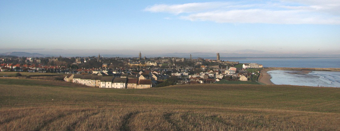
St. Andrews seen from southeast January 11, 2008.
The general weather
situation, measurement equipment and measurement route
The weather was pleasant with patches of frost on the ground. Air temperatures was around 3oC, and the sky almost clear. Winds were light from southwest, about 0.5-1.5 m/s.
A thermistor mounted inside a
radiation shield was attached to the roof of a car (c. 1.5 m above terrain), and
temperatures were logged at 2 sec. intervals. The time given in the diagrams
below is according to normal winter zonal time. The measurements were carried
out for a route passing through the city from west to southeast, as shown by
the map below.
St. Andrews
is located at 56o20'N
2o50'W, on the east coast of
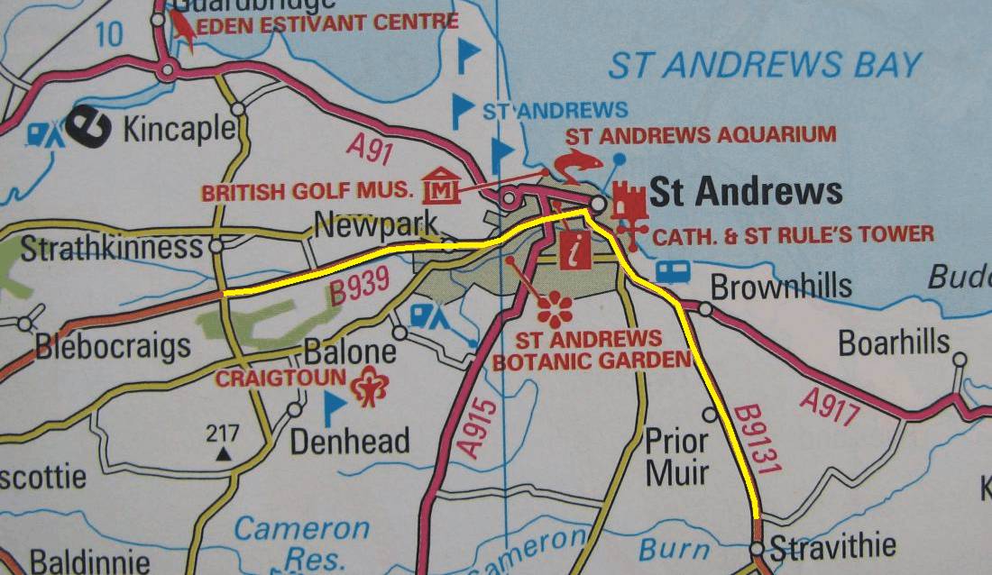
Map showing location of the measurement route (yellow). The map measures
12 km from west to east. The altitude ranges from 5 to 60 m
asl., highest at the endpoints of the traverse.
Results
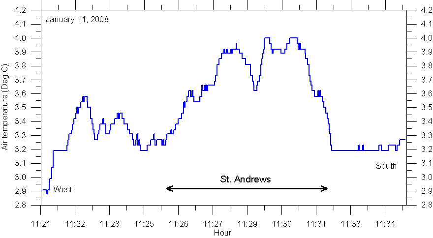
Result
of temperature traverse 11 January 2008: Starting in rural landscape west of